Mount Roraima (Venezuela) formed 2 billion years ago is really a “lost world” and completely isolated from the rest. Things don’t seem to have changed much in the last millions of years.
Located between the borders of three countries, Roraima is the highest mountain in the Pakaraima range, located in the Canaima National Park, Venezuela.
The mountain is located on the border of all three countries, Venezuela, Guyana and Brazil.
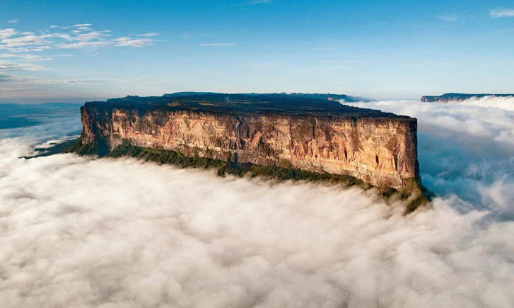
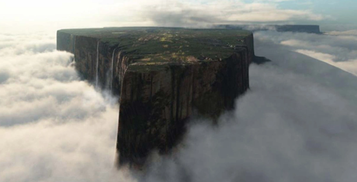
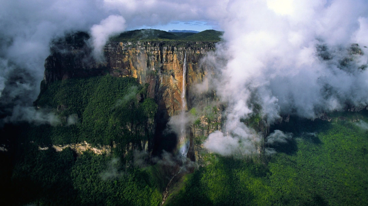
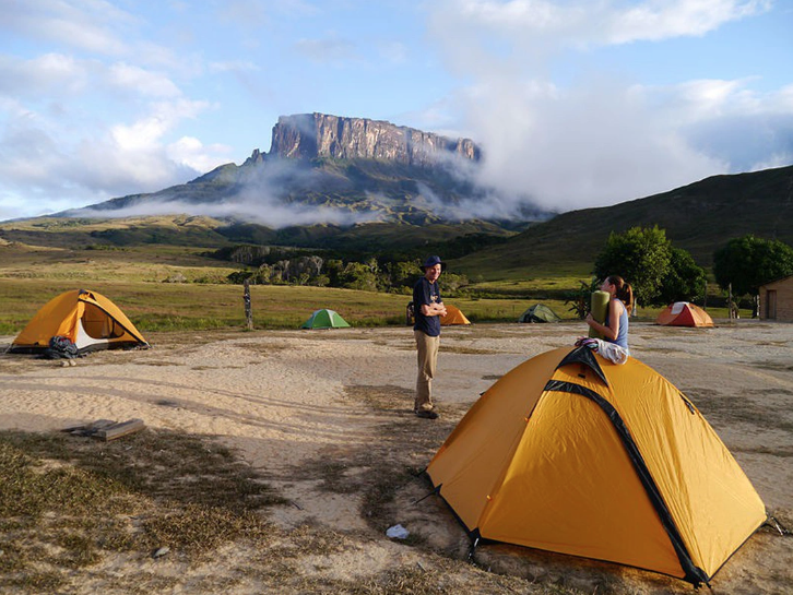
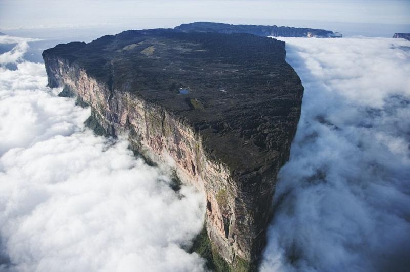
Roraima also known as Tepuy Roraima, Cerro Roraima or “tepui” in the local language, this flat-topped mountain emerges as if carved from a monolith, with a steep cliff about 400m high.
The highest point of Roraima is 2,810m above sea level (located in Brazilian territory), while the plateau on the top of the mountain has an area of about 30km2, located at an altitude of 2,338m.
Described as an “island” in the sky, Roraima has the most mysterious and ancient appearance in the world. The mountain is home to the oldest geological foundation, dating back to about 2 billion years ago.
This mountain is thought to be the remains of a large sandstone plateau north of the Amazon and Orinoco river basins, the result of changes in the Earth’s surface as the continents drifted long ago. several billion years and South America was separated from West Africa.
Roraima was first described by English explorer Sir Walter Raleigh during his 1595 expedition in search of the legendary golden city of El Dorado, but he was unable to climb to the top.
The mountain officially became widely known when Arthur Conan Doyle used it as the inspiration to write the fiction novel “The Lost World” published in 1912.
In 2003, scientists discovered in the heart of Mount Roraima in Venezuela the cave system “Cueva Ojos de Cristal”, nearly 11km long and 72m deep.
The highest part of Mount Roraima is almost always covered with white clouds and fog, giving it a mysterious and magical look.
Roraima was a very sacred place and had special significance for the indigenous people before the Europeans came to explore.
In the Pémon language, “tepui” means “house of the gods” and is associated with most of the local legends.
n December 1884, Sir Edvard im Thurn was the first person to climb Mount Roraima, following the unique path used by the Pémon natives and still used by climbers to this day.
In recent years, thanks to the boom of the Venezuelan tourism industry, every year thousands of people flock here to conquer Mount Roraima.
Mount Roraima is located near the Venezuelan towns of Saint Elena de Uairén and San Francisco de Yuraní (Kumarakapay), and most expeditions are started here.
Visitors can hire local guides or join expedition groups to conquer the mountain.
If you are rich, you can rent a helicopter to get to the top of the mountain as quickly as possible.
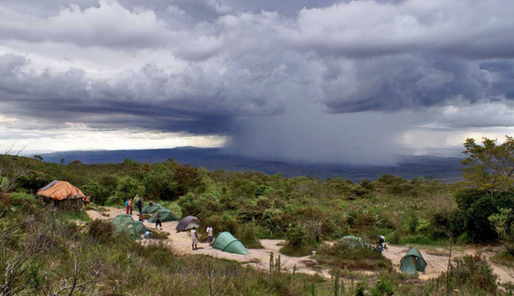
The journey to climb Mount Roraima is not “relaxed” at all. Visitors need to prepare all necessary equipment because it takes up to two days to reach the top and another two days to return.
For experienced athletes and climbers, they often choose to conquer Roraima from Guyana and Brazil, because this route has a higher difficulty.
The most ideal time to conquer Roraima is in the dry season (from December to April). Although called the dry season, the climate in Roraima is not “dry” at all, the weather changes very quickly, it rains a lot, the temperature is low and there is always fog.
The top of the mountain is home to many species of flora and fauna, 35% of which are endemic to Roraima. Many plant species are found in the mountains including orchids, bromeliaceae, and carnivorous plants. Animals and insects found in the mountains include spiders of the family Theraphosidae, Roraima toads, and over 300 species of birds.
Mount Roraima and its summit are truly a “lost world” and completely isolated from the rest, where things don’t seem to have changed much in millions of years.